Heritage by area - Dublin 15
From Blanchardstown to Corduff, Clonsilla to Kilmartin and from Mulhuddart to St Catherines, this south-west corner of Fingal has seen great changes over the years from fields and forts to industrialisation and a new suburban landscape.
Archaeology & History
Almost 90 archaeological monuments are recorded within Dublin 15. Some cannot be seen easily on the ground but many tree covered mounds, stumps of buildings, churches and castles walls give us clues to the stories of the people who have lived, worked and died here throughout the ages.
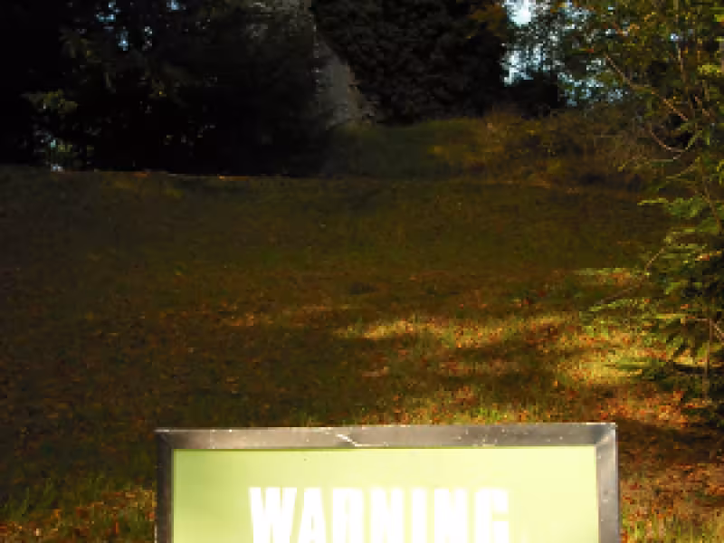
Archaeological excavations and stray finds have uncovered traces of people living in this area since the Bronze Age but it is in the Christian period that people began to leave traces that we still see today. From the fifth to the eleventh centuries (the early medieval period), some people lived in circular enclosures defined by a ditch and bank, known as raths or ringforts such as those at Cappogue, Corduff, Astagob, Balcurris, Coldwinters and Porterstown. These were the typical farmsteads of the period.
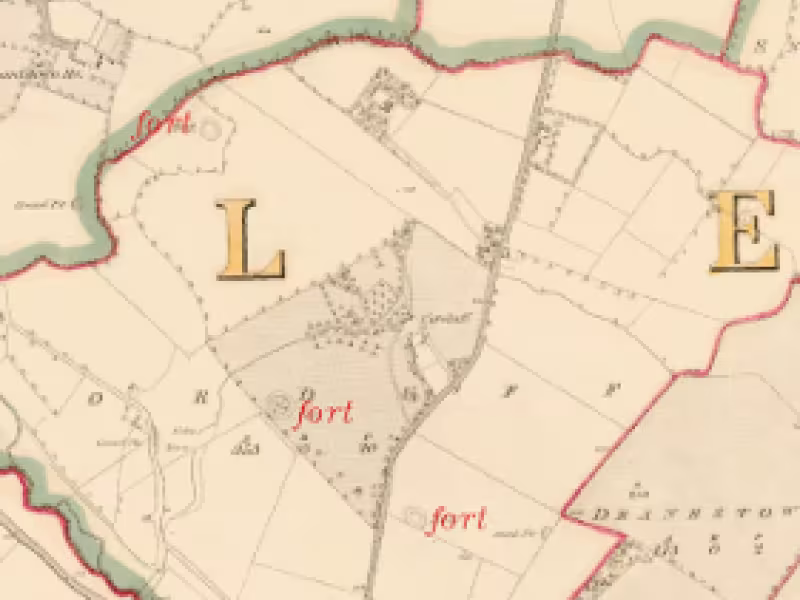
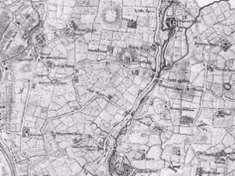
1st Edition Ordnance Survey Map 1837 above (Ordnance Survey of Ireland © under licence 2012-24-CCMAI-FCC). Three forts are marked within Corduff alone
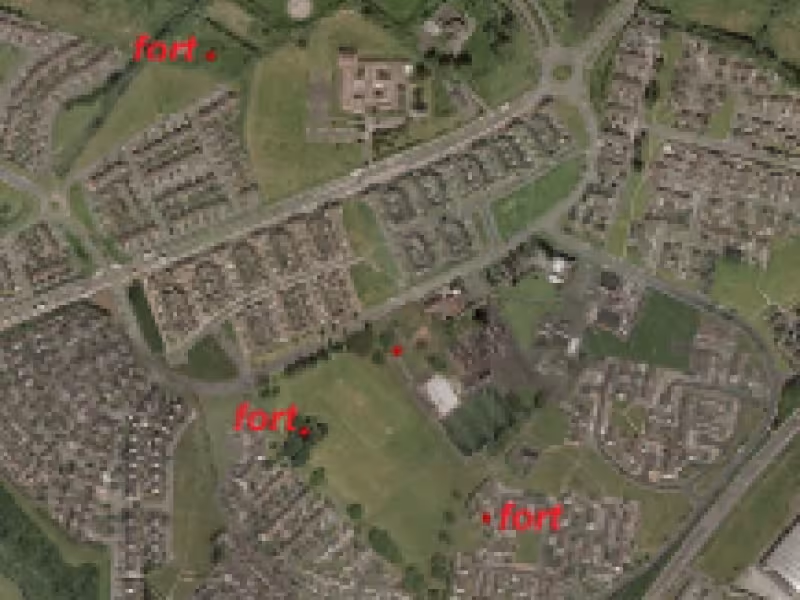
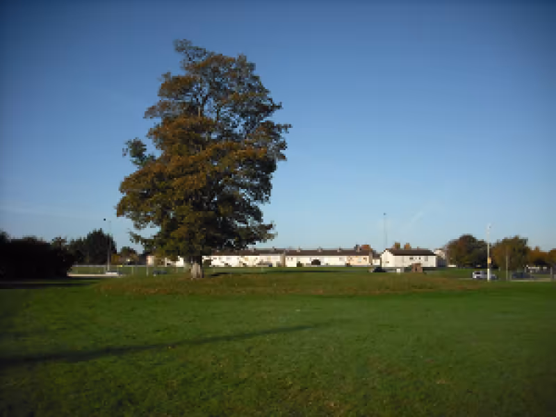
The same three forts within Corduff almost 180 years later; one is under a housing estate, another can be seen in Corduff park and the most northern is in the open space of Warrenstown estate.
The earliest churches are also represented. Bishop Tírechán writing in the seventh century provides a list of the churches established by St Patrick, the first being that of Cul Mine, interpreted as Coolmine near Clonsilla. Traditionally thought to be the site of the White Chapel of St Machutus, it was a possession of St Mary’s Abbey and had passed out of existence by 1429. Recent geophysical survey by John Nicholls has defined its remains within the Millennium Park, Blanchardstown. Other examples of medieval churches that may have had their origins in the early medieval period such as Abbotstown, Buzzardstown, and Clonsilla.
Site of the White Chapel, Coolmine
Within 400m of the motte and castle at Castleknock a medieval pottery kiln of the 13/14th century was excavated. Most of the production consisted of ladles, pipkins cooking vessels and jugs.
The Anglo-Norman families of Blanchard, Tyrell, Deuswell and Keppock have left their legacy not only in the townland names (Blanchardstown, Tyrellstown, Diswellstown and Cappogue) but in a physical landscape of the area. The manor of Castleknock was granted to Hugh Tyrell in 1177 and included Castleknock, Clonsilla and Mulhuddart. It is at Castleknock that one of the largest motte and baileys survive, topped with a stone polygonal keep. Despite the fortifications Edward Bruce managed to take the castle and hold the baron and his family ransom in 1317. The poet William Wordsworth saw the castle in 1829 and thought it to ‘possess a melancholy as well as a wildness peculiarly striking in the vicinity of a great town’. Mottes are also recorded at Kilshane, Newtown, and Dunsoghley.
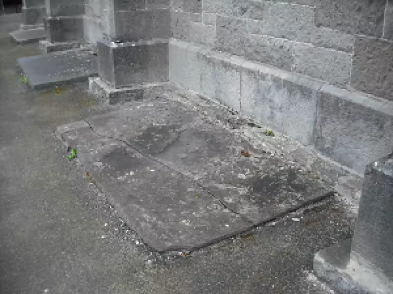
A graveslab erected to Frances Lady Newcomen of Sutton who died 1687, Clonsilla graveyard
Integral to the granting of land was a devotion to the church and a commitment to the development of parishes. Many properties were granted to the church such as the land at Dunsink given to the nunnery of Lismullen, and lands at Coolmine, Clonsilla and Blanchardstown were granted to the Priory of Little Malvern, England. Churches were endowed or financially supported by men and women intent on the saving their souls and so medieval churches are amongst the most numerous surviving monuments from the period.
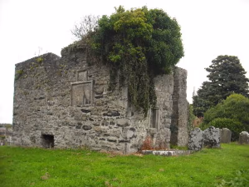
Mulhuddart Church and Graveyard
The medieval church was dedicated to the Blessed Virgin Mary in the early 15th century. In 1532 Henry VIII granted a licence to found a fraternity or guild at the site
The 17th century was a period of upheaval in south-west Fingal. It is recorded that between 1641 and 1649 the parish of Mulhuddart was overrun by contending armies and laid waste. The Duke of Ormond made the church at Mulhuddart his quarters while Owen Roe O’Neill marched through the parish. Records show that there were a total of thirty-six inhabitants in Huntstown at this time; just twenty-nine in Blanchardstown and forty-five in Diswellstown. There was an upsurge in big houses in the area in the 18th century as families rebuilt or new families took up residence. Not always successfully-in 1761 the gable wall of Buzzardstown House collapsed killing the mother and daughter of the house. Many houses such as Corduff House, occupied by the Warren family for over 200 years no longer survive. Others such as Abbotstown, former residence of Lord Holmpatrick and Luttrellstown House survive but are not accessible.
Rocque’s map of 1760-the large houses and their gardens are shown alongside church, fields and quarries and woods
Henry Luttrell was credited with the erection of the Devil’s Mills before his murder in 1717 although the depiction by Jonathon fisher in 1761 indicates they may be a later development. There were also mills at Blanchardstown and Castleknock. The Royal Canal was another infrastructural undertaking. Known as the Rival canal or the Cobblers canal in reference to Mr Binns, a retired shoemaker and member of the Board of the Grand Canal. He fell out with the other board members and set up a rival canal company. Works commenced in 1790 but were slowed considerably by two miles of deep sinking between Blanchardstown and Clonsilla. This set-back effectively bankrupted the company and it was eventually sold to the Midland Western railway to build a railway alongside. It was while walking along the canal that William Rowan Hamilton (1805-65) discovered the theory of quaternions, a revolutionary mathematical concept that he carved into the stone work at Broombridge. He was the director of the observatory at nearby Dunsink. Selected for its vantage point and distance from the smog of Dublin, Dunsink observatory was built in 1785, the instruments and layout designed by Rev. Henry Ussher.
Abbotstown Graveyard. Associated with St Caoemhín with a possible early medieval origin the site contains church remains, graveyard and holy well. ‘Caveen’s well was closed up by the landlord. Surviving headstones indicate many Dublin merchants were buried here in the 18th century. Since the building of the M50 the graveyard is no longer publically accessible.
Folkore
Tall tales can often have a kernel of truth in them especially when they grow up around placenames- ancient skeletons have been actually been found in fields known as the Bone field and long forgotten settlements in Old-towns. In the annals Castleknock was known as Cnucha and is connected to Conn of the Hundred battles and became a seat of kings. Tradition has it that when a priest was saying mass at Cloghran he saw a person stealing a horse and foal. The priest uttered ‘God amend thee’ to the robber, which was applied to the neighbouring townland as Goddamendy. Legends are also associated with the early churches and their founders. Cul Mine interpreted as Coolmine was listed as the first church St Patrick founded within Brega while St Mochta associated with Clonsilla apparently raised a drowned thief from the dead.
Did you know?
That in 1564 wood from Castleknock was supplied for the reconstruction of the nave of Christ Church?
Contrary to popular belief most of Ireland’s natural forests were cleared before 1600, much of this clearance in prehistoric times. In medieval times there were scattered woods and copses. However much of present day Blanchardstown was covered in woodland known as the Great Scaldwood.
Did you know?
That there were wolves in Blanchardstown until 1652?
There was an organised wolf cull in the Great Scaldwood in 1652. Highwaymen and robbers added to the dangers of the area. The Red Lyon, near Dubber was a hostelry where travellers who ‘feared to risk the perils of the notorious woods after nightfall’ could stop.
Did you know?
There was brewery in Clonsilla from the 17th century?
One of just ten malt houses in the Dublin region in the 1640s was at Clonsilla. Barley and other grains were malted for brewing. In the middle ages malting and brewing were frequently carried out by women.
Did you know?
That Queen Victoria visited Luttrellstown Castle twice in 1849 and 1900?
Her visit of 1900 was commemorated by the erection of an obelisk in the Glen where she had taken tea and more irreverently in the lines of the well-known song ‘‘The Queen she came to call on us, She wanted to see all of us, Good job she didn’t fall on us, She’s eighteen stone’
Find out more
Local history Collection: Blanchardstown Library, The Civic Centre, Blanchardstown Centre Email [email protected]
Baker, C. 2010, Antiquities of old Fingal; the archaeology of north County Dublin. Wordwell. Dublin.
Ball F.E. 1995 (reproduced from 1906 lithograph), A History of the County Dublin: The people, parishes and antiquities from the earliest times to the close of the eighteenth century. Part Fourth. The HSP Library, Dublin.
Lacey, J. 1999, A Candle in the Window; a history of the Barony of Castleknock. Marino Books, Dublin.
Murphy, M. & Potterton, M. 2010, The Dublin Region in the Middle Ages; settlement, land-use and economy. Discovery Programme Monograph, Wordwell, Dublin.